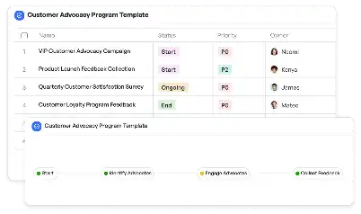
Disaster Relief Helicopter Logistics Map
Achieve project success with the Disaster Relief Helicopter Logistics Map today!

What is Disaster Relief Helicopter Logistics Map?
The Disaster Relief Helicopter Logistics Map is a specialized tool designed to streamline the coordination and deployment of helicopters during disaster relief operations. This template is essential for managing the complex logistics involved in delivering critical supplies, evacuating affected individuals, and conducting aerial assessments in disaster-stricken areas. By providing a structured framework, it ensures that resources are allocated efficiently and that all stakeholders are aligned in their efforts. For instance, during a flood, helicopters are often the only viable means of reaching isolated communities. This map helps in planning routes, prioritizing tasks, and ensuring timely delivery of aid. Its importance cannot be overstated, as it directly impacts the effectiveness of disaster response efforts.
Try this template now
Who is this Disaster Relief Helicopter Logistics Map Template for?
This template is ideal for emergency response teams, disaster management agencies, and humanitarian organizations. Key users include logistics coordinators, helicopter pilots, field operation managers, and government officials involved in disaster relief. For example, a logistics coordinator can use this map to plan the most efficient routes for helicopter deliveries, while a pilot can rely on it for real-time updates on weather conditions and landing zones. Field operation managers can track the progress of multiple helicopters simultaneously, ensuring that all critical areas are covered. This template is also invaluable for NGOs working in disaster-prone regions, enabling them to respond quickly and effectively to emergencies.

Try this template now
Why use this Disaster Relief Helicopter Logistics Map?
Disaster relief operations often face unique challenges, such as inaccessible terrain, unpredictable weather, and limited resources. This template addresses these pain points by providing a centralized platform for planning and coordination. For instance, it allows users to identify the most critical areas in need of assistance, allocate helicopters accordingly, and monitor their progress in real-time. It also includes features for tracking fuel consumption, scheduling maintenance, and ensuring compliance with safety protocols. By using this template, organizations can minimize delays, reduce the risk of errors, and maximize the impact of their relief efforts. In a scenario where every second counts, this tool can make the difference between life and death.

Try this template now
Get Started with the Disaster Relief Helicopter Logistics Map
Follow these simple steps to get started with Meegle templates:
1. Click 'Get this Free Template Now' to sign up for Meegle.
2. After signing up, you will be redirected to the Disaster Relief Helicopter Logistics Map. Click 'Use this Template' to create a version of this template in your workspace.
3. Customize the workflow and fields of the template to suit your specific needs.
4. Start using the template and experience the full potential of Meegle!
Try this template now
Free forever for teams up to 20!
The world’s #1 visualized project management tool
Powered by the next gen visual workflow engine


