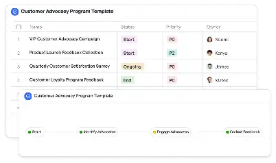
Livestock Grazing Pattern Analysis Map
Achieve project success with the Livestock Grazing Pattern Analysis Map today!

What is Livestock Grazing Pattern Analysis Map?
The Livestock Grazing Pattern Analysis Map is a specialized tool designed to visualize and analyze the movement and grazing patterns of livestock across various terrains. This map is essential for understanding how livestock interact with their environment, optimizing grazing schedules, and ensuring sustainable land use. By incorporating data from satellite imagery, field surveys, and historical grazing records, this map provides a comprehensive overview of grazing dynamics. For instance, in arid regions, it helps identify overgrazed areas and suggests alternative pastures, thereby preventing land degradation and promoting ecological balance.
Try this template now
Who is this Livestock Grazing Pattern Analysis Map Template for?
This template is ideal for ranchers, agricultural consultants, environmental scientists, and policymakers. Ranchers can use it to monitor livestock movement and optimize grazing schedules. Agricultural consultants can leverage it to provide data-driven recommendations to their clients. Environmental scientists can study the impact of grazing on ecosystems, while policymakers can use the insights to draft regulations for sustainable land use. For example, a rancher managing a herd of cattle across a 500-acre farm can use this map to identify underutilized pastures and improve livestock distribution.

Try this template now
Why use this Livestock Grazing Pattern Analysis Map?
The Livestock Grazing Pattern Analysis Map addresses several critical challenges in livestock management. Overgrazing, uneven pasture utilization, and lack of data-driven decision-making are common issues. This map provides actionable insights by integrating real-time data and historical trends. For instance, it can highlight areas prone to overgrazing, allowing ranchers to redistribute livestock and prevent soil erosion. Additionally, it aids in planning rotational grazing schedules, ensuring that pastures have adequate recovery time. By using this map, stakeholders can achieve sustainable livestock management, enhance productivity, and contribute to environmental conservation.

Try this template now
Get Started with the Livestock Grazing Pattern Analysis Map
Follow these simple steps to get started with Meegle templates:
1. Click 'Get this Free Template Now' to sign up for Meegle.
2. After signing up, you will be redirected to the Livestock Grazing Pattern Analysis Map. Click 'Use this Template' to create a version of this template in your workspace.
3. Customize the workflow and fields of the template to suit your specific needs.
4. Start using the template and experience the full potential of Meegle!
Try this template now
Free forever for teams up to 20!
The world’s #1 visualized project management tool
Powered by the next gen visual workflow engine


