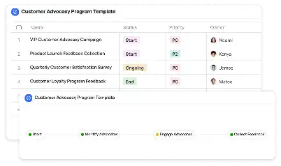
Disaster Recovery Drone Surveillance Plan
Achieve project success with the Disaster Recovery Drone Surveillance Plan today!

What is Disaster Recovery Drone Surveillance Plan?
The Disaster Recovery Drone Surveillance Plan is a specialized framework designed to utilize drone technology for assessing and managing disaster recovery efforts. This template is particularly critical in scenarios where rapid response and accurate data collection are essential, such as natural disasters, industrial accidents, or large-scale emergencies. By leveraging drones, teams can quickly survey affected areas, gather high-resolution imagery, and analyze data to prioritize recovery actions. The plan ensures that all stakeholders are aligned on the objectives, timelines, and resources required for effective disaster management. In the context of modern disaster recovery, drones have become indispensable tools, offering unparalleled access to hazardous or inaccessible zones, thereby enhancing safety and efficiency.
Try this template now
Who is this Disaster Recovery Drone Surveillance Plan Template for?
This template is ideal for emergency response teams, disaster management agencies, and organizations involved in large-scale recovery operations. Typical users include drone operators, data analysts, project managers, and field coordinators. For instance, a municipal disaster response team can use this plan to coordinate efforts during a flood, while a private company might deploy it to assess damage after an industrial accident. The template is also valuable for NGOs and humanitarian organizations working in disaster-prone regions, enabling them to streamline their operations and focus on delivering aid effectively.

Try this template now
Why use this Disaster Recovery Drone Surveillance Plan?
Disaster recovery scenarios often involve complex challenges such as inaccessible areas, time-sensitive decisions, and resource constraints. This template addresses these pain points by providing a structured approach to drone-based surveillance. For example, in a wildfire scenario, drones equipped with thermal imaging can identify hotspots, enabling firefighters to allocate resources more effectively. Similarly, in a post-earthquake situation, drones can survey structural damage, allowing engineers to prioritize repairs. The template also includes guidelines for data analysis and reporting, ensuring that decision-makers have actionable insights. By using this plan, organizations can enhance their disaster recovery capabilities, minimize risks, and accelerate the path to normalcy.

Try this template now
Get Started with the Disaster Recovery Drone Surveillance Plan
Follow these simple steps to get started with Meegle templates:
1. Click 'Get this Free Template Now' to sign up for Meegle.
2. After signing up, you will be redirected to the Disaster Recovery Drone Surveillance Plan. Click 'Use this Template' to create a version of this template in your workspace.
3. Customize the workflow and fields of the template to suit your specific needs.
4. Start using the template and experience the full potential of Meegle!
Try this template now
Free forever for teams up to 20!
The world’s #1 visualized project management tool
Powered by the next gen visual workflow engine


