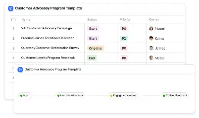
Local Park Delivery Pathways Map
Achieve project success with the Local Park Delivery Pathways Map today!

What is Local Park Delivery Pathways Map?
The Local Park Delivery Pathways Map is a specialized tool designed to streamline the planning and execution of delivery routes within local parks. This template is particularly valuable for park management teams, logistics coordinators, and community planners who aim to optimize pathways for deliveries while ensuring minimal disruption to park visitors. By leveraging this map, teams can visualize delivery routes, identify potential bottlenecks, and implement solutions that enhance efficiency. For instance, in urban parks with high foot traffic, the map can help delineate specific delivery zones, ensuring that service vehicles do not interfere with pedestrian pathways. This tool is indispensable for maintaining the balance between operational needs and visitor experience, making it a cornerstone for modern park logistics.
Try this template now
Who is this Local Park Delivery Pathways Map Template for?
This template is ideal for a diverse range of users, including park administrators, logistics managers, and urban planners. Park administrators can use it to coordinate maintenance deliveries, such as equipment or supplies, without disrupting daily park activities. Logistics managers benefit from the map by planning efficient delivery schedules that align with park regulations and visitor patterns. Urban planners can utilize the template to design pathways that accommodate both delivery vehicles and pedestrian traffic, ensuring safety and accessibility. Additionally, event organizers hosting activities in parks can rely on this map to manage vendor deliveries and setup logistics seamlessly. The Local Park Delivery Pathways Map is a versatile tool tailored to meet the unique needs of these stakeholders.

Try this template now
Why use this Local Park Delivery Pathways Map?
The Local Park Delivery Pathways Map addresses several critical challenges faced in park logistics. One common issue is the lack of clear delivery routes, which can lead to delays and confusion among delivery personnel. This template provides a structured framework for mapping out precise pathways, reducing ambiguity. Another pain point is the potential for delivery vehicles to disrupt pedestrian areas, posing safety risks. By using this map, teams can designate specific delivery zones, ensuring a safe and organized environment. Furthermore, the template helps in identifying and mitigating bottlenecks, such as narrow pathways or restricted access points, which can hinder efficient deliveries. By addressing these challenges, the Local Park Delivery Pathways Map becomes an essential tool for enhancing operational efficiency and visitor satisfaction in park settings.

Try this template now
Get Started with the Local Park Delivery Pathways Map
Follow these simple steps to get started with Meegle templates:
1. Click 'Get this Free Template Now' to sign up for Meegle.
2. After signing up, you will be redirected to the Local Park Delivery Pathways Map. Click 'Use this Template' to create a version of this template in your workspace.
3. Customize the workflow and fields of the template to suit your specific needs.
4. Start using the template and experience the full potential of Meegle!
Try this template now
Free forever for teams up to 20!
The world’s #1 visualized project management tool
Powered by the next gen visual workflow engine


